Through the lens
Egypt’s Lost Eden
A visual essay by Catherine Hyland
Text—Simon Ings
Photos—Catherine Hyland
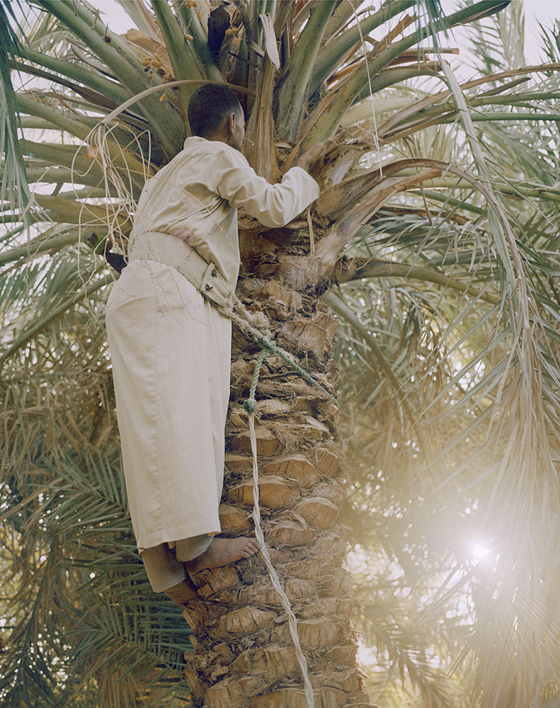
Three hundred and fifty miles southwest of Cairo, in the middle of the 263,000-square-mile depression that is Egypt’s Western Desert, lies a town called Farafra. There is an oasis here and gardens large enough that every old family in the town gets its own not-inconsiderable patch. Dates, olives, and lemons grow here. There has never been a time the town has not been able to feed itself.
Farafra stands somewhat apart from the prevalent Cairo culture. How could it do otherwise? It’s not too far from the Libyan border and peopled, at its core, by Bedouin who still recall the old trade routes.
More to the point, Farafra is old: older than Cairo; older even than 5,000-year-old Thebes (Luxor, to you). The earliest settlements around here are more than 10,000 years old. Before Farafra, there were no settlements in Egypt — at least none that we know of.
The area around Farafra is where people learned the art of staying put.
It’s an irresistibly romantic idea that outposts of greenery have persisted in what is now one of the most arid spots on earth. In colonial times, European geographers, adventurers, and archaeologists staggered from one oasis to another, notebook and compass in hand, stepping, so they reckoned, on the bones of an Eden lost under the desert dust.


They weren’t wrong. In a cave a few hours’ drive southwest of Farafra, there survive Stone Age carvings of goats, gazelles, a giraffe, and — the clincher — a boat.
Water, wind, and sand
____
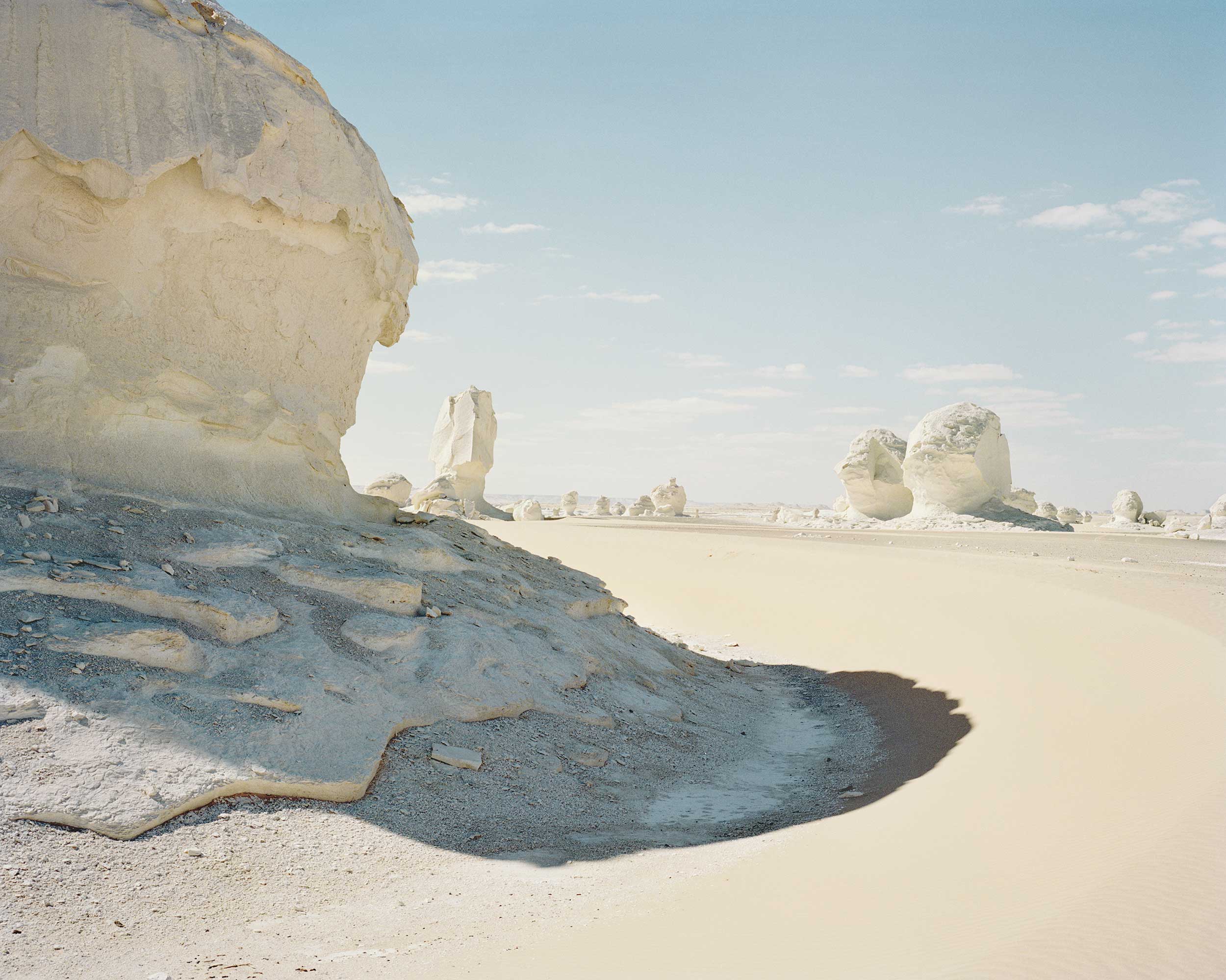
Imagining a desert underwater or in bloom is simple. The hard part is coming to terms with how long ago this region — now the White Desert National Park — dried up.
This place was already desert by the time of the pharaohs, and Farafra was no more than a stopover on the route linking the Mediterranean Sea with the Libyan Sahara. The land was ungrazed and unquarried; even the indefatigable Romans, when they occupied, managed only a few artesian wells.
Yet romantic dreams of a lost Eden pertained even then — why else would the region have been dubbed Ta-iht or “land of the cow”?The thing is, you won’t find a single cow represented among the bones petrifying here. Camels, yes. Gazelles. Ostriches. (The shells of ostrich eggs served so well as vessels that no one thought to make pottery here.)
So why should a Nile-based civilization want to remember a dry, obscure, inhospitable corner of neighbouring desert as a land of plenty? Archaeological work over the past quarter century provides the answer.
Civilization didn’t start by the Nile. It started here, in the wetlands around Farafra. The habit of herding and farming spread eastward as the land dried up.
The memory of rain
____
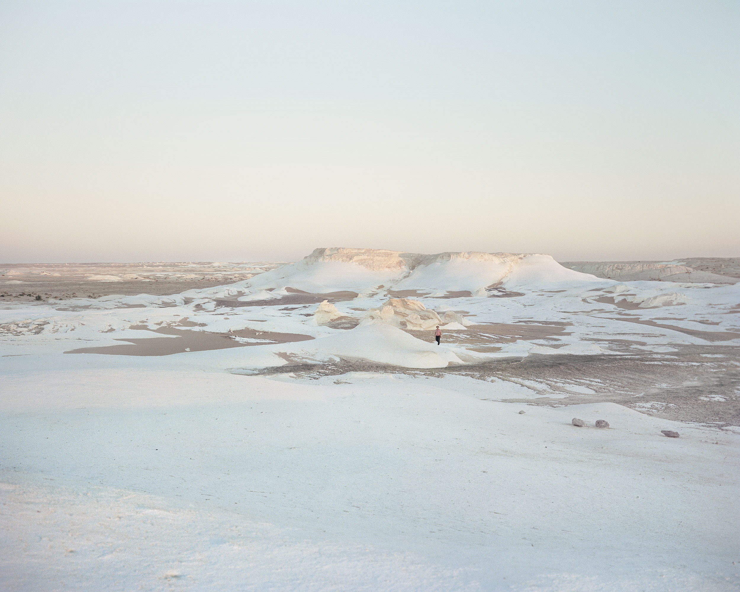
You can drive into the White Desert but you’d be a fool to try it without a guide; camels and a week for exploration are best. The desert is mountainous and cantilevered like solidified clouds.
Where sand and wind have carved the valley’s chalk bed as they might a glacier, you struggle to take a photograph that doesn’t look like Iceland. Turn around and wind-driven sand is pouring through gaps in the mountains, and it suddenly dawns on you that you’ve lost sight of your camp.
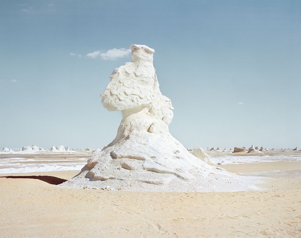
Yes, walk, by all means, but keep your wits about you; a change in the light changes the colour of everything. And nothing, absolutely nothing, in this place looks the same from two angles. This is the land that symmetry forgot.
The White Desert is white enough, or whatever colour the sun makes refracting off the chalk that the lakes left behind — every possible orange, every possible mauve, at dawn some improbable Arctic blues.
Dark streaks turn out to be nodules of iron from old volcanoes or the petrified remains of acacia trees. Here and there the ground is littered with fragmented stone twigs. The spindly trunks of young tamarisks remain rooted in the chalk, turned to a softish stone that you can crack between your hands.
This area has been dry for so long that its geology no longer remembers rain. There are no drainage lines, no gullies, no riverbeds, only the shores of ancient lakes, and even these are hard to spot in a landscape shaped entirely by wind and sand.


When Mariner 9 and the Viking lander and orbiter took pictures of Mars, NASA trawled its library of satellite images of earth to find the nearest terrestrial equivalent of what they were seeing. Study of the White Desert informs NASA’s current mission planning.
Returning to Farafra, we sat drinking tea, watching dates being harvested, nodding ruefully as our guide explained how the earthen-built center of Farafra had by now almost vanished, untended and unoccupied, as contemporary local families embrace hot-in-summer, cold-in-winter concrete for their homes.
That will change. The idea of a town of earthen houses built along winding, shaded alleys may look old to the locals, but to western tourists of a new breed it is a model of sustainable modernity. One day Farafra will rebuild itself into something new and strange — and not for the first time in 10,000 years.
Catherine Hyland is an artist based in London. She graduated from Chelsea College of Art and Design with a First class BA (Hons) Degree in Fine Art and completed her Masters at the Royal College of Art. Her photography centres around people and their connection to the land they inhabit. Primarily landscape-based, her work is rooted in notions of fabricated memory, grids, enclosures, and national identity.